
3. บันทึกข้อมูลในภูมิประเทศลงบนแผนที่ การบันทึกข้อมูลลงในแผนที่โดยทราบสัดส่วนหรือมาตราส่วนของแผนที่สามารถทำได้ โดยง่าย ซึ่งมีหลักการเบื้องต้นของการเก็บบันทึกข้อมูลดังนี้
Recording data in the field onto a map. The process of recording data on a map, with knowledge of the scale or proportion of the map, can be easily accomplished. There are basic principles for data recording as follows:
3.1 เมื่อทราบมาตราส่วนของแผนที่ Know the map scale:
- คำนวณระยะใน 1 หน่วยแผนที่เทียบกับระยะจริงบนภูมิประเทศ เช่น แผนที่ที่ใช้อ้างอิงจัดเก็บข้อมูลมีมาตราส่วน 1 : 1,000 หมายความว่า 1 เซนติเมตร เท่ากับ 100 เมตร
Calculate the distance in 1 map unit compared to the actual distance on the ground. For example, if the reference map used for data collection has a scale of 1:1,000, it means that 1 centimeter on the map is equivalent to 100 meters.
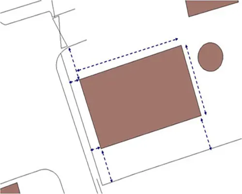
- หาตำแหน่งอ้างอิงและทิศทางในแผนที่
Identify reference points and directions on the map.
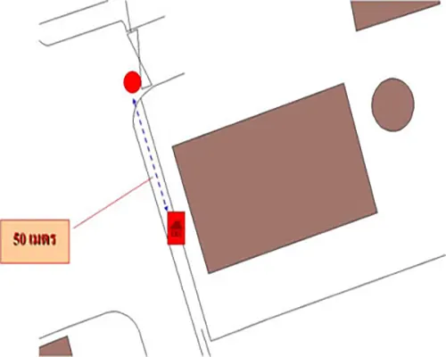
- ลงตำแหน่งข้อมูล เช่น เมื่อลงตำแหน่งตู้โทรศัพท์ซึ่งอยู่ห่างจากทางแยกประมาณ 50 เมตร โดยอาจจะวัดระยะด้วยเทปหรือการนับก้าวระหว่างจุดสนใจกับจุดที่ปรากฏในแผนที่
Position the data, for example, when positioning a telephone booth about 50 meters away from the intersection, which may measure the distance by tape or the step between the points of interest and the points shown on the map.
3.2 เมื่อไม่ทราบมาตราส่วนของแผนที่ Unknown map scale:
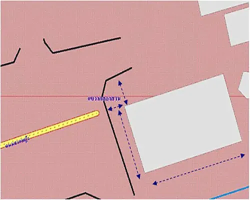
หาระยะอ้างอิงในแผนที่และในภูมิประเทศที่ทราบระยะจริง เช่นความยาวของถนนที่ เข้าอาคารสำนักงานประมาณ 100 เมตร เทียบสัดส่วนกับแผนที่ซึ่งวัดได้ยาวประมาณ 1 เซนติเมตร จะได้มาตราส่วนโดยประมาณ คือ 1 เซนติเมตร: 100 เมตร หรือ 1 เซนติเมตร : 100 x 100 เซนติเมตร นั่นคือแผนที่มีมาตราส่วนโดยประมาณเท่ากับ 1 : 10000
Determine the reference distance on the map and in the known actual distance. For example, the length of the road leading to the office building is approximately 100 meters, compared to a map that measures about 1 centimeter. The estimated scale would be 1 centimeter: 100 meters or 1 centimeter: 100 x 100 centimeters. This means that the map has an approximate scale of 1:10,000.
ลงตำแหน่งข้อมูลเช่นเดียวกับกรณีทราบมาตราส่วนของแผนที่ข้างต้น
Record the data position as in the case where the scale of the map is known.