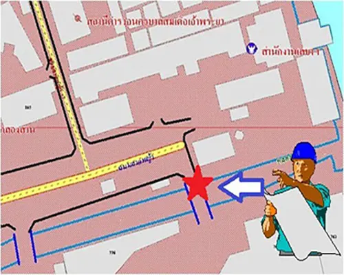
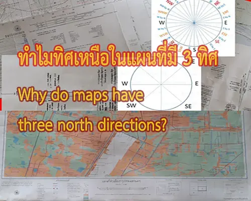
1.1 ถ้าแผนที่มีสัญลักษณ์ ทิศเหนือ ให้ทำการเทียบทิศทางกับทิศทางในภูมิประเทศจริง
แล้ววางแผนที่ให้ถูกทิศทาง
If the map has a compass symbol indicating the north, correctly align the map according to the true geographical direction.
1.2 กรณีแผนที่ไม่สมบูรณ์และไม่ได้แสดงสัญลักษณ์ทิศเหนือไว้ ผู้ใช้แผนที่ควรสังเกต
ลักษณะภูมิประเทศจริงเปรียบเทียบกับสัญลักษณ์ที่ปรากฏในแผนที่อย่างน้อย 3 จุด เช่น ในภูมิประเทศจริง ที่ตั้งสำนักงานเขตอยู่ด้านขวา สถานีดับเพลิงอยู่ด้านซ้ายมือ และโรงพยาบาลอยู่ด้านหน้าของผู้ใช้แผนที่ ให้สมมุติว่าผู้ใช้แผนที่ยืนอยู่บนแผนที่แล้ว ที่ตั้งสำนักงานเขตอยู่ด้านขวา สถานีดับเพลิงอยู่ด้านซ้ายมือและโรงพยาบาลอยู่ด้านหน้าของผู้ใช้แผนที่ด้วยเช่นกัน หลังจากนั้นจึงเขียนสัญลักษณ์ทิศเหนือลงในแผนที่ กรณีที่ไม่ทราบทิศทางในภูมิประเทศผู้ใช้แผนที่สามารถสังเกตดวงอาทิตย์ในช่วง เช้า หรือเย็น ซึ่งจะทำให้ทราบทิศว่าเป็นทิศตะวันออกหรือตะวันตกได้โดยประมาณ จากนั้นผู้ใช้แผนที่สามารถเขียนสัญลักษณ์ทิศเหนือโดยประมาณลงในแผนที่ได้จาก การยืนให้ด้านขวามืออยู่ด้านทิศตะวันออก ซ้ายมืออยู่ด้านทิศตะวันตกซึ่งด้านหน้าก็จะเป็นทิศเหนือแล้วสมมุติจุดยืน เหมือนข้างต้นและหมุนแผนที่ให้ตรงลักษณะภูมิประเทศจริงแล้วจึงเขียนทิศเหนือ บนแผนที่เพื่อเป็นจุดสังเกตต่อไป
With an incomplete map without a compass symbol, users should observe the actual geographical features and compare them with at least three points on the map. For example, if the district office is to the right, the fire station is to the left, and the hospital is in front of the map user, the user should assume their standing position on the map. If the district office is to the right, the fire station is to the left, and the hospital is in front, the user can then draw the north symbol on the map. Where the actual direction is unknown, users can observe the sun in the morning or evening to approximate east or west. The user can then draw an estimated north symbol on the map by standing with the right-hand facing east and the left-hand facing west, and the front will be considered north.
2. หาตำแหน่งบนแผนที่ที่ผู้ใช้แผนที่ยืนอยู่ โดยเริ่มจากลักษณะที่ปรากฏบนภูมิประเทศอย่างน้อยๆ 3 จุด ทางด้านซ้าย ด้านขวา และด้านหน้าหรือด้านหลังของผู้ใช้แผนที่ แล้วจึงเทียบเคียงกับลักษณะที่ปรากฏบนแผนที่
After that, the user can find three points on the map that correspond to the left, right, and front or back of their standing position, and compare them with the actual geographical features.