

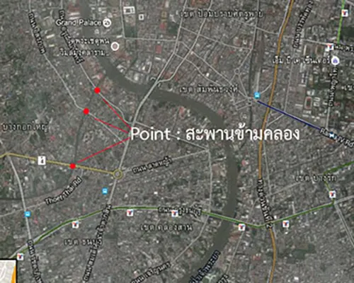
Bridge over the canal: we should set the feature type as Line because the Bridge over the canal has a substantial length and width. The total length of a bridge is often more than 5 meters, allowing it to be drawn on the map with a width of 5 millimeters. While the smallest width of a canal cross bridge is maybe 1 to 2 meters, drawing it on the map with a width of 2 millimeters is challenging. Therefore, it is not recommended to set the feature type as Polygon. Usually, the bridges over the canal are represented by their length and the direction they span the canal, making it appropriate to set the feature type as a Line.
อย่างไรก็ตาม ถ้าแผนที่ฐานหรือแผนที่ที่ต้องการพิมพ์แสดงผลมาตราส่วน 1 : 10,000 แล้ว การกำหนดชนิดของคุณลักษณะข้อมูล (Feature Type) สะพานข้ามคลองควรกำหนดเป็น Point เนื่องจากในแผนที่มาตราส่วน 1 : 10,000 จะแสดงสะพานข้ามคลองได้เพียงตำแหน่งสะพานเท่านั้น (สะพานความยาว 5 เมตร แสดงในแผนที่ 1 : 10,000 ได้เพียง 0.5 มิลลิเมตรเท่านั้น)
However, if the base map or map intended for printing has a scale of 1:10,000, specifying the feature type for the Bridge over the canal as a Point is advisable. In a 1:10,000 scale map, representing a 5-meter bridge length would only be 0.5 millimeters on the map.
หลักการเบื้องต้นเกี่ยวกับการจัดเก็บข้อมูลภาคสนามด้วยแผนที่ Basic principles regarding field data collection with maps.
เมื่อกำหนดลักษณะชนิดของคุณลักษณะข้อมูล (Feature Type) ได้แล้ว การจัดเก็บข้อมูลภาคสนามมีขั้นตอนดำเนินการดังนี้
Once the feature type of the data has been determined, the field data collection process involves the following steps:
1. วางตำแหน่งทิศของแผนที่ให้ถูกต้องตามทิศของภูมิประเทศจริง ดังนี้
Accurately orienting the map's position according to the true geographical direction, as follows: