





ฤดูกาลของประเทศไทย: ปัจจัยเบื้องหลังสามฤดูกาลของประเทศไทย – ฤดูร้อน ฤดูฝน และฤดูหนาว
อธิบายลักษณะการเกิดและช่วงเวลาของฤดูกาลในประเทศไทย ตลอดจนการเข้าสู่ฤดูกาลที่ไม่เป็นไปตามช่วงเวลาปกติ ด้วยสภาวะการเปลี่ยนแปลงอุณหภูมิของโลกที่อาจะเกิดขึ้นจากการกระทำของมนุษย์และการเกิดปรากฏการณ์ “เอลนีโญ” “ลานีญา”
Explain the characteristics and seasonal timing of Thailand’s climatic seasons, including deviations from their normal onset and duration resulting from global temperature changes, human activities, and the influences of El Niño and La Niña events.
ประเทศไทยแบ่งออกได้เป็น 3 ฤดู
Thailand's Three Seasons
1. ฤดูร้อน ระหว่างกลางเดือนกุมภาพันธ์ถึงกลางเดือนพฤษภาคม
Summer Season, From Mid-February to Mid-May
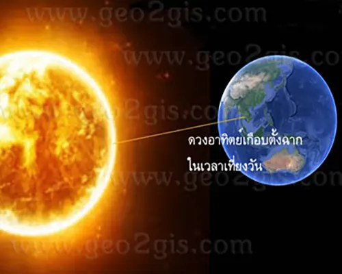
เป็นช่วงที่ขั้วโลกเหนือหันเข้าหาดวงอาทิตย์ บริเวณประเทศไทยจึงได้รับความร้อนจากดวงอาทิตย์เต็มๆ โดยเฉพาะช่วงเดือนเมษายนดวงอาทิตย์เกือบตั้งฉากในเวลาเที่ยงวันทำให้ร้อนจัด
The period when the Northern Hemisphere tilts toward the sun is characterized by intense heat in Thailand, particularly during April when the sun is nearly overhead around noon, resulting in scorching temperatures.
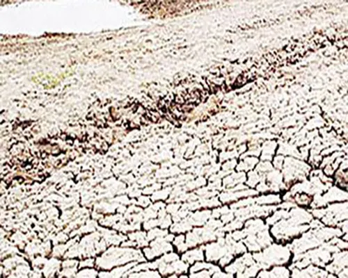
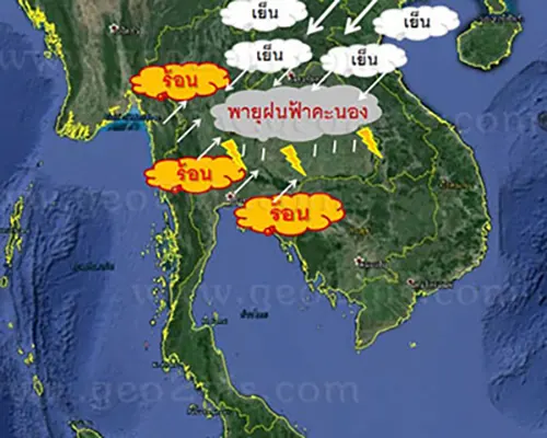
อย่างไรก็ตามบางช่วงที่มีมวลอากาศเย็นแผ่ลงมาจากประเทศจีนอาจทำให้เกิดการปะทะกันระหว่างมวลอากาศร้อนกับมวลอากาศเย็นทำให้เกิดพายุฝนฟ้าคะนองลมกระโชกแรงหรืออาจมีลูกเห็บตก แต่ก็อาจจะช่วงทำให้อุณหภูมิเย็นลงได้บ้าง
However, during certain periods, the intrusion of cool air masses from China may lead to clashes between warm and cool air masses, giving rise to intense thunderstorms, gusty winds, or even the possibility of hailstorms. Nevertheless, there are also intervals during which this interaction results in a decrease in temperature.
2. ฤดูฝน ระหว่างกลางเดือนพฤษภาคมถึงกลางเดือนตุลาคม
The Rainy Season, From mid-May to mid-October.

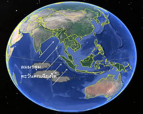
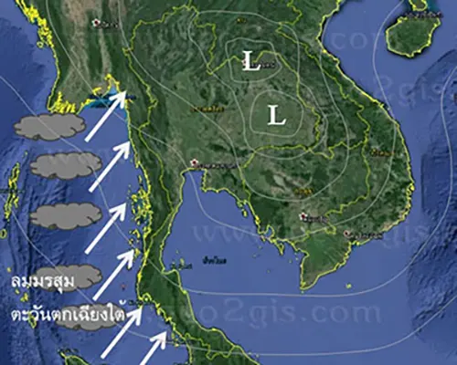
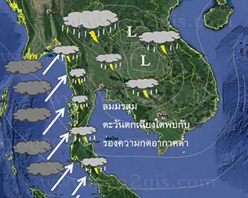
โดยประมาณกลางเดือนพฤษภาคมลมมรสุมตะวันตกเฉียงใต้ปกคลุมประเทศไทยทำให้มีเมฆมากและฝนตกชุกทั่วไป โดยเฉพาะบริเวณชายฝั่งทะเลและเทือกเขาด้านรับลม เนื่องจากลมมรสุมตะวันตกเฉียงใต้มีแหล่งกำเนิดจากบริเวณมหาสมุทรอินเดียทางซีกโลกใต้ พัดเอามวลอากาศชื้นข้ามเส้นศูนย์สูตรมาสู่ประเทศไทย มาพบกับร่องความกดอากาศต่ำที่พาดผ่านประเทศไทย
Around mid-May, the southwesterly monsoon prevails over Thailand, bringing extensive cloud cover and widespread rainfall, particularly along the coastal and mountainous regions facing the wind. Originating from the Indian Ocean on the southern hemisphere side, the southwesterly monsoon carries moist air masses across the equator to Thailand, where they meet low-pressure troughs passing through the country.
อย่างไรก็ตามในฤดูฝนปกติจะมีฝนทิ้งช่วงในช่วงประมาณปลายเดือนมิถุนายนเนื่องจากร่องความกดอากาศต่ำที่พาดผ่านประเทศไทยทางตอนใต้จะเลื่อนขึ้นไปทางเหนือเลยออกไปทางตอนใต้ของจีน หลังจากนั้นประมาณช่วงเดือนกรกฎาคมร่องความกดอากาศต่ำก็จะเลื่อนลงมาทางใต้ผ่านประเทศไทยอีกครั้งจึงทำให้มีฝนตกชุก
Nevertheless, during the normal rainy season, there is typically a rain lull around late June, as low-pressure troughs that initially pass through southern Thailand gradually shift northward and exit through the southern part of China. Subsequently, around July, another low-pressure trough descends southward through Thailand, resulting in a renewed period of heavy rainfall.