


3.2 เมื่อไม่ทราบมาตราส่วนของแผนที่ Unknown map scale:
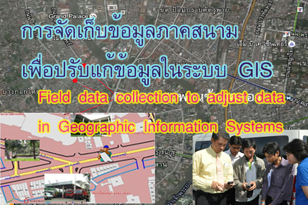
หาระยะอ้างอิงในแผนที่และในภูมิประเทศที่ทราบระยะจริง เช่นความยาวของถนนที่ เข้าอาคารสำนักงานประมาณ 100 เมตร เทียบสัดส่วนกับแผนที่ซึ่งวัดได้ยาวประมาณ 1 เซนติเมตร จะได้มาตราส่วนโดยประมาณ คือ 1 เซนติเมตร: 100 เมตร หรือ 1 เซนติเมตร : 100 x 100 เซนติเมตร นั่นคือแผนที่มีมาตราส่วนโดยประมาณเท่ากับ 1 : 10000
Determine the reference distance on the map and in the known actual distance. For example, the length of the road leading to the office building is approximately 100 meters, compared to a map that measures about 1 centimeter. The estimated scale would be 1 centimeter: 100 meters or 1 centimeter: 100 x 100 centimeters. This means that the map has an approximate scale of 1:10,000.
ลงตำแหน่งข้อมูลเช่นเดียวกับกรณีทราบมาตราส่วนของแผนที่ข้างต้น
Record the data position as in the case where the scale of the map is known.
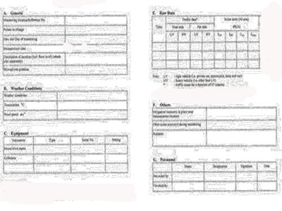
4. บันทึกรายละเอียดข้อมูลตามแบบบันทึกที่เตรียมไว้
Record details of the information according to the prepared recording format.
อย่าง ไรก็ตาม เทคโนโลยีที่ทันสมัยในปัจจุบัน สามารถลดเวลาในการสำรวจเพื่อจัดทำข้อมูลในระบบ GIS ได้ แต่วิธีการคำนวณที่ถูกซ้อนอยู่ในเทคโนโลยีอาจจะทำให้ผู้ใช้ไม่รู้ว่าข้อมูลที่ได้มาคลาดเคลื่อนเกินกว่าที่จะ นำไปใช้งาน
However, in today's modern technology, It is possible to reduce exploration time to create data in the GIS system, but the calculation methods that are stacked in the technology may cause users to not know that the data obtained is too inaccurate to be used.